Historic Landscape
Characterisation
The Gwent Levels
The Gwent Levels Historic Landscape of Outstanding Historic Interest in Wales, as cited in Part 2:1 of the Register of Landscapes, Parks and Gardens of Outstanding Historic Interest in Wales, 1998. The area (Ref number HLW(Gt)2) includes the Gwent Levels Sites of Special Scientific Interest (various) and Redwick Conservation Area.
The Outstanding Historic Landscape of Gwent Levels comprises three discrete and extensive areas of alluvial wetlands and intertidal mudflats situated on the north side of the Severn Estuary represent the largest and most significant example in Wales of a 'hand-crafted' landscape. They are entirely the work of man, having been recurrently inundated and reclaimed from the sea from the Roman period onwards. The areas have distinctive patterns of settlement, enclosure and drainage systems belonging to successive periods of use, and a proven and possibly quite vast potential for extensive, well-preserved, buried, waterlogged, archaeological and palaeoenvironmental deposits surviving from earlier landscapes.
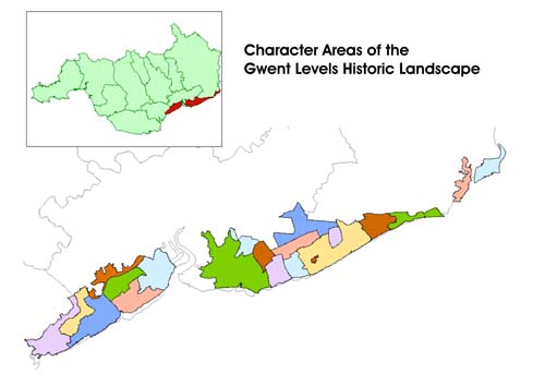
The Gwent Levels was the first area for which a landscape characterisation
study was attempted. This was undertaken on behalf of Cadw: Welsh Historic
Monuments and the Countryside Council for Wales by Dr Stephen Rippon (now
at University of Exeter) in 1995. Dr Rippon was able to divide what appears
to be a flat, uniform landscape into 21 distinct areas. The boundaries
of these character areas and the reasons for individual distinction remain
unchanged. However detailed descriptions have been edited so that they
take a similar form, as far as is possible, to the later detailed character
area descriptions for other landscapes recorded in the Register. This
has been done so as not to alter the information in the original document.
As the historic landscape is considered to be largely agricultural with
minor settlement, the usual section on landscape themes has been replaced
by information on landscape development, with a particular emphasis on
water management and drainage.
The following description, taken from the Historic Landscapes Register, identifies the essential historic landscape themes in the historic character area.
The Gwent Levels are an extensive low lying area of estuarine alluvium located on the north side of the Severn estuary in south-east Wales between Cardiff and the River Rhymney in the west and Chepstow on the River Wye in the east. Topographically the Levels are taken as extending south of the 10m contour line, approximately the fen edge or interface with solid geology to the north (roughly coinciding with the modern east-west line of the London to Cardiff railway), though they are generally at their lowest near the boundary with the solid geology.
The Levels are a landscape of extraordinarily diverse environmental and archaeological potential. Although they are an important wetland resource in their own right, archaeologically the area contains a variety of landscapes of different dates, and nowhere else is it possible to make the period distinctions so easily. Man's past activities in the area have been governed by the vast tidal range within the Severn Estuary, which has seen major and minor fluctuations in the heights and range of tides since the last glaciation, caused by variations in both the land and sea level. The Levels reflect man's evolving and often precarious relationship with these circumstances over the last ten thousand years.
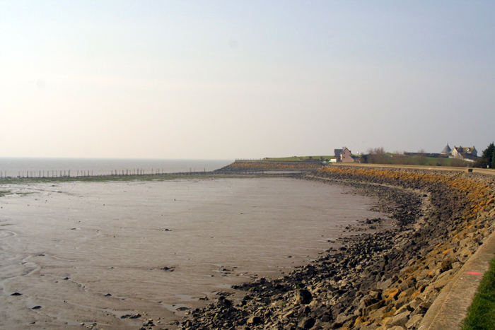
Having been reclaimed from the sea at various times during the historic period, the present land surface is a supreme example of a 'hand-crafted' landscape, artificially created and entirely the work of man, preserving clear evidence of distinctive patterns of settlement, enclosure and drainage systems. However, because of recurrent phases of inundation and alluviation, there is also a proven, and quite possibly vast, potential for extensive, buried, waterlogged, archaeological and environmental deposits belonging to the earlier landscapes, which extend beyond the seawalls and banks into the intertidal mudflats. The Levels are therefore a uniquely rich archaeological and historical resource in Wales, and certainly of international importance and significance.
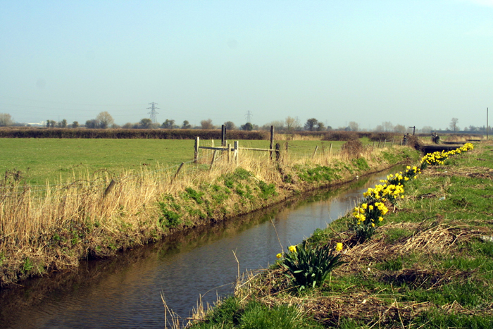
Man's greatest impact on the wetland landscape has been his determination and success in reclaiming the levels, which has been on-going at least since the Roman period. Although the area is crossed by natural drainage, principally the River Usk with its broad tidal estuary, the Rivers Rhymney and Ebbw, and the Goldcliff Pill, the greater part of the levels has been the subject of artificial drainage schemes, so that today the area is criss-crossed by drainage channels, known locally as reens. However, elements of older drainage networks are still incorporated into some of the artificial drainage networks inland of the sea walls, whilst other elements have been abandoned, either at the time of reclamation or more recently. The abandoned drainage systems are represented by palaeochannels, some of which are clearly seen on aerial photographs.
The present derived landscape thus comprises the following features: major reens resulting from natural watercourses; major reens which are wholly artificial; inland abandoned sea banks whose origins are obscure; sea walls probably originating in the 16th century; gouts where reens meet and coffer gouts where they cross; pills where the major reens discharge either into tidal channels or into the estuary itself; the bridges across the reens and the roadways built upon embankments; and not least the distinctive and characteristic field patterns belonging to different phases of enclosure.
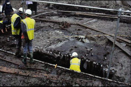
In relation to the buried, archaeological landscape, Mesolithic remains have been discovered at Goldcliff, stratified in an estuarine clay underlying a sequence of peat deposits. Additionally, late Mesolithic human footprints, impressed into the lower Wentlooge Formation have been found at Uskmouth. Again they were preserved in estuarine clay beneath a deposit of clay. It is reasonable to suppose that other important evidence of Mesolithic activity will be found preserved further inland, and perhaps most particularly at the interface between the levels and solid geology to the north.
Bronze Age activity has been recorded at various sites on desiccated raised peat beds, such as at Chapel Tump. More recently, outside the area described here, at Caldicot Castle, there is detailed evidence of palaeochannels, pile structures, a boat strake and a considerable amount of cultural material. Iron Age evidence has been discovered in the intertidal zone at Goldcliff with rectangular timber buildings, trackways and fishtraps on a shelf of fen peat. Also outside, but near the area, at Barland's Farm, Wilcrick, Roman stone and timber structures and the remains of a late 3rd century Romano-British boat have been found, alongside a buried tidal creek, emphasizing the remarkable state of preservation of archaeological material in the levels.
The Middle Ages are represented by a large number of Anglo-Norman sites including castles, moated sites, churches, mills, manor houses and court houses. There is evidence of continuity in the forms of land use between the medieval and post-medieval periods. The area saw increasing enclosure of the fields although, as late as 1830, considerable areas remained common. Whilst much of the basic network of reens had been established before this period, it continued to be developed and modified, particularly as the land became enclosed.
Over recent years, a range of spectacular archaeological sites have been excavated and, since 1987, a series of Sites of Special Scientific Interest have been notified in the Levels. The present landscape represents the latest archaeological period and provides the diverse ecological niches on which the nature conservation interests depend.
Gwent Levels Historic Landscape Study Themes
- The Historic Landscape
- Buried Archaeology
- Landscape Formation
- Landscape Typology
- Water Management and the Drainage
System
- Sea Wall
- Main Reens
- Lesser Reens
- Field Ditches
- Surface Ridging in Fields
- Bridge
- Standing Buildings
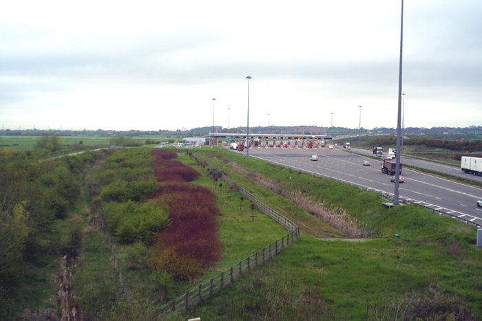
01 Nash/Goldcliff coastal zone character
area: complex "irregular landscape" in higher coastal area,
with small irregular fields, sinuous lanes and dispersed settlement.
(Photo: GGAT Gwent Levels 033)
(Back to map)
Click here for further information
about this Historic Landscape Characterisation Area
Click here for a character area map
(Photo: GGAT Gwent Levels 042)
(Back to map)
Click here for further information about this Historic Landscape Characterisation Area
Click here for a character area map
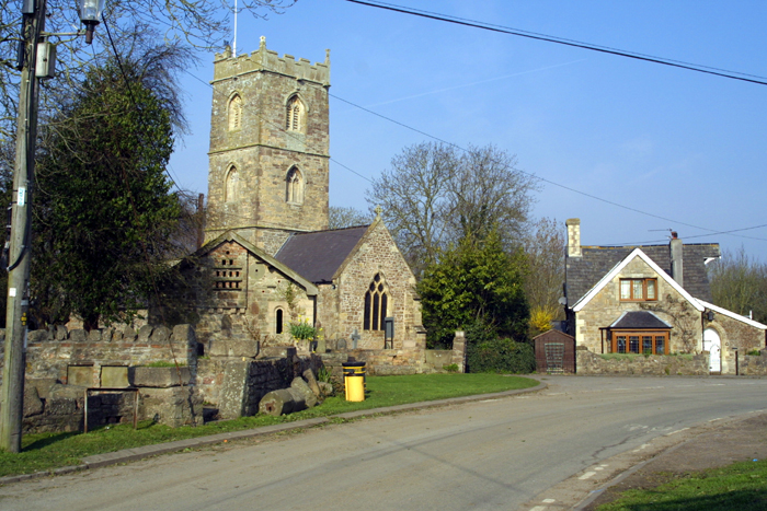
03 Whitson character area: unique planned
village
(Photo: GGAT Gwent Levels 041)
(Back to map)
Click here for further information about this Historic Landscape Characterisation Area
04 Porton character area: unusual "intermediate"
type landscape by the coast.
(Photo: GGAT Gwent Levels 030)
(Back to map)
Click here for further information about this Historic Landscape Characterisation Area
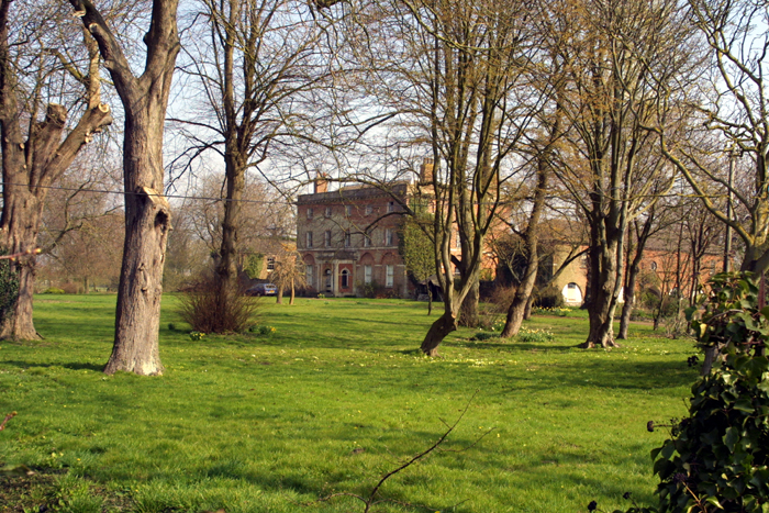
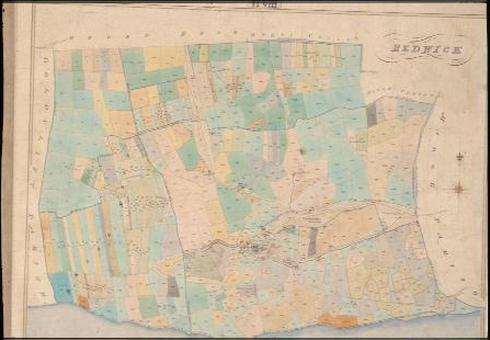
05 Redwick village character area: the
best-preserved nucleated settlement on the Level.
(Photo: GGAT Gwent Levels 013)
(Back to map)
Click here for further information about this Historic Landscape Characterisation Area
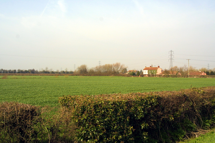
06 Redwick/Magor/Undy character area:
complex "irregular landscape" with some dispersed settlement.
(Photo: GGAT Gwent Levels 026)
(Back to map)
Click here for further information about this Historic Landscape Characterisation Area
Click here for a character area map
07 Redwick Broadmead character area: "regular
landscape" derived from the Parliamentary enclosure of open-fields.
(Photo: GGAT Redwick CSmap)
(Back to map)
Click here for further information about this Historic Landscape Characterisation Area
Click here for a character area map
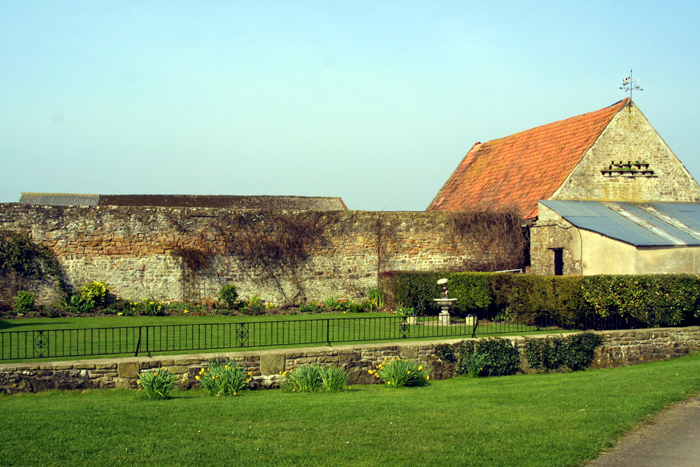
08 Northern Redwick character area: fairly
simple landscape, including Tintern Abbey's estate at Grangefield.
(Photo: GGAT Gwent Levels 028)
(Back to map)
Click here for further information about this Historic Landscape Characterisation Area
Click here for a character area map
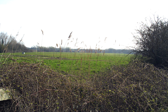
09 Green Moor character area: simple landscape
in the back-fen of Redwick/Llandevenny/Magor.
(Photo: GGAT Wilkinson Site Exc3)
(Back to map)
Click here for further information about this Historic Landscape Characterisation Area
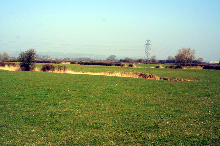
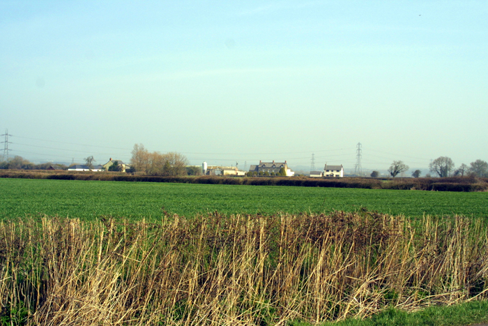
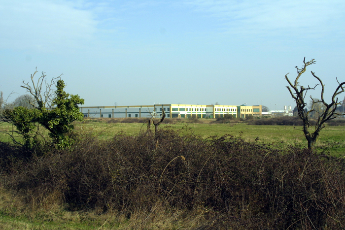
10 Magor Lower Grange character area:
another of Tintern's estates, drained in the mid-thirteenth century.
(Photo: GGAT Gwent Levels 022)
(Back to map)
Click here for further information about this Historic Landscape Characterisation Area
Click here for a character area map
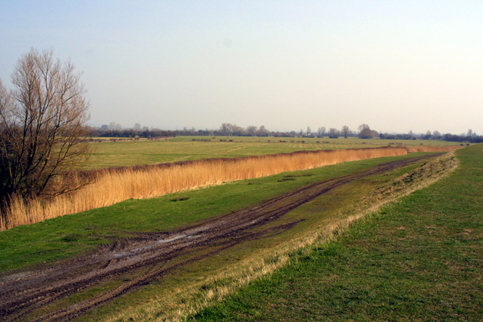
11 Caldicot Moor character area: "regular
landscape" resulting from Parliamentary enclosure in 1850.
(Photo: GGAT Gwent Levels2 021)
(Back to map)
Click here for further information about this Historic Landscape Characterisation Area
Click here for a character area map
12 Caldicot fen-edge character area: unusual
area of small irregular fields by the fen-edge.
(Photo: GGAT Gwent Levels 006)
(Back to map)
Click here for further information about this Historic Landscape Characterisation Area
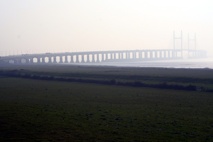
13 St. Pierre character area: reclamations
around the mouth/valley of St. Pierre Pill.
(Photo: GGAT Gwent Levels2 002)
(Back to map)
Click here for further information about this Historic Landscape Characterisation Area
14 Mathern
character area: small parcel of coastal alluvium.
(Photo: GGAT Gwent Level2 017)
(Back to map)
Click here for further information about this Historic Landscape Characterisation Area
Character Areas on the Wentlooge Level
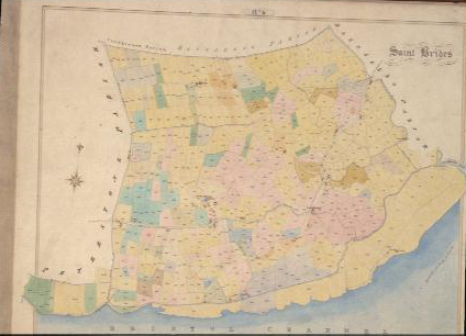
15 Eastern St. Brides character area:
complex "irregular landscape" on higher coastal area.
(Photo: GGAT St Brides CSmap)
(Back to map)
Click here for further information about this Historic Landscape Characterisation Area
16 Western St. Brides: simpler landscape,
laid out within a framework of elements surviving from the Roman landscape.
(Photo: GGAT Gwent Levels 100)
(Back to map)
Click here for further information about this Historic Landscape Characterisation Area
Click here for a character area map
17 Peterstone character area: "regular
landscape" of Roman date.
(Photo: GGAT Gwent Levels 096)
(Back to map)
Click here for further information about this Historic Landscape Characterisation Area
18 Rumney character area: complex "irregular
landscape" with dispersed settlement pattern.
(Photo: GGAT Gwent Levels 050)
(Back to map)
Click here for further information about this Historic Landscape Characterisation Area
19 Trowbridge character area: fairly simple
landscape in the low-lying back-fen.
(Photo: GGAT Gwent Levels 084)
(Back to map)
Click here for further information about this Historic Landscape Characterisation Area
20 Marshfield/Coedkernew character area:
low-lying back-fen landscape north of major "catchwater drain".
(Photo: GGAT Gwent Levels 093)
(Back to map)
Click here for further information about this Historic Landscape Characterisation Area
Click here for a character area map
21 Maerdy character area: "regular
landscape" of medieval/post-medieval date in low-lying back-fen.
(Photo: GGAT Gwent Levels 099)
(Back to map)
Click here for further information about this Historic Landscape Characterisation Area
Click here for a character area map